Winners
Grand Prize
Kawaragawa River and Kawaragawa River Park
144 Namisugi to 133-2 Shimowano, Takada-cho, Rikuzentakada-shi, Iwate
Rivers and river parks
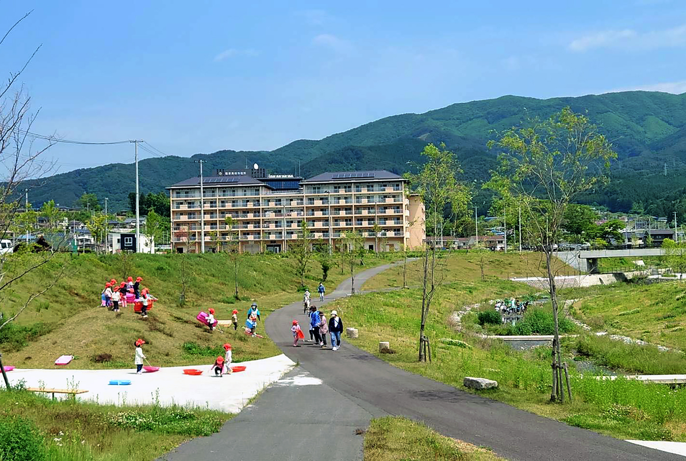
In the Takada area, which was severely damaged by the Great East Japan Earthquake of March 11, 2011, a land use plan was formulated to raise the entire residential area, and Kawahara River Park was incorporated into the plan. This is an important perspective to incorporate the river as a natural foundation in a city that has been drastically transformed by mankind.
This work is a project to design the Kawahara River and the park located along the river as an integrated space and connect it to the raised city. Shinichi Yoshimura, who is familiar with river administration and has experience in river design, joined the project as design supervisor, and a joint prefectural and municipal committee of practitioners coordinated the project. Ltd. was in charge of the river design, Oriental Consultants Co., Ltd. was in charge of the park basic design, and the park implementation design was undertaken by Ryokkei-Kyodo Sekkei Design Joint Venture.
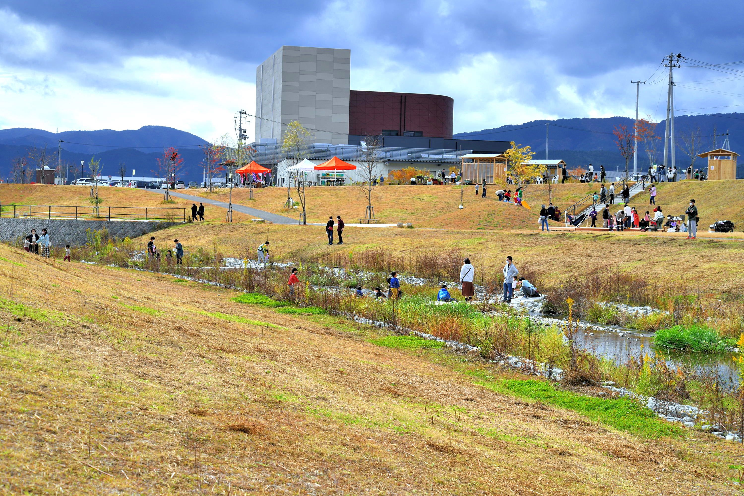
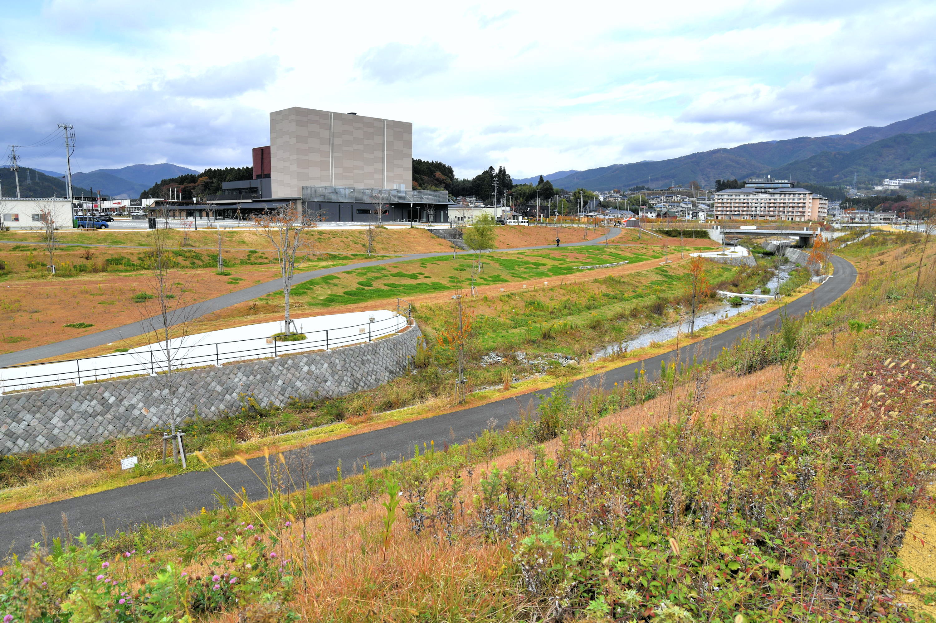
The river is now three times deeper (8 to 9 m) than it was before the earthquake due to the construction fill. The core of the design in this work is a spatial design that transforms the deepening river into a familiar living space. We aimed to create a spatial form that integrates the complex shapes and bustling life created by the river that makes people want to approach the water’s edge without feeling its depth, the river’s various shapes that are not uniform, and the views of Mt. An “integrated space” cannot be created simply by combining a river and a park. In order to create a “town space that is both a river and a park,” the boundary between the river and the park was not defined, but the boundary between the river and the park was determined as a result of the integrated design. However, there is no boundary as a space, and a space that is both a river and a park was designed.
The “love for the Kawahara River” of the city hall staff and local residents also encouraged the project. Tree planting on the river site, a submerged bridge to be submerged during flooding, and a “controlled bridge” for residents to cross were realized through the wise decision of the river administrator. Soon after its completion, children from Takada Nursery School began to play there, making it an educational site. Weeding work by the Kawahara River Fan Club and local residents and “Let’s Play on the Kawahara River” activities are just a few of the events that have taken place, which are an inheritance of the lives of the children in the past and will lead to the future.
This is probably the only example of a reconstruction project that makes the most of the river. The Kawahara River is the axis of inheritance of nature, culture, and memories of Rikuzentakata.
- 《Main parties involved》
- ○Shinichi Yoshimura (Shinichi Yoshimura Watershed Planning Office, Inc.)/Design supervision, joint prefectural/city meeting
○Yo Yamamoto (Kanto Branch, Oriental Consultants Co., Ltd.)/Basic design of Kawarakawa Park, overall coordination
○Masaru Abe (then Urban Planning Division, Construction Department, Rikuzentakata City, now Regional Development Department, Rikuzentakata City)/General coordination of Kawarakawa Park, joint prefectural and municipal meetings, decision-making
○Satoru Nagayama (Urban Planning Division, Construction Department, Rikuzentakata City) / overall coordination of Kawarakawa Park, joint prefectural and municipal meetings
○Tadashi Katayama (Ofunato Civil Engineering Center, Iwate Prefecture (at that time), Construction Technology Promotion Division, Iwate Prefecture (at present))/Overall coordination of the Kawarakawa River development, joint meeting of the prefecture and the city
○Hiroshi Kikuchi (Ofunato Public Works Center, Iwate Prefecture (at that time), Miyako Public Works Center, Iwate Prefecture (at present))/Overall coordination of the Kawahara River development, joint meeting of the prefectural and municipal governments
○Takashi Honma (then Ofunato Public Works Center, Iwate Prefecture, now Public Works Department, Iwate Prefecture Northern Regional Development Bureau)/Overall coordination of the Kawahara River development, joint meeting of the prefecture and the city
○Yuji Okada (then), Nei & Partners Japan (now) / basic design of Kawahara River Park, public opinion exchange meeting, model production
○Hidehiro Kokubo (Asian Kosaku Corporation)/Kawahara River basic design, Kawahara River implementation design, overall coordination
○Yoko Kudo (Asia Koso Co., Ltd.)/Kawahara River Basic Design, Kawahara River Implementation Design
○Shigemasa Naka (Ryokkei Corporation, Tokyo Office)/Kawahara River Park Implementation Design, Overall Coordination
○Daikiya Inoue (Ryokkei Tokyo Office) / Kawahara River Park Implementation Design
- 《Main organizations involved》
- ○Prefecture/City Joint Meeting on Kawahara River and Kawahara River Park /Comprehensive coordination on integrated design of river (Iwate Prefecture) and park (Rikuzentakata City)
○Ofunato Public Works Center, Iwate Prefecture / River development integrating flood control, environment, and human use, coordination with park project, and construction supervision
○River Division, Land Development Department, Iwate Prefecture/comprehensive coordination related to river projects, realization of river green areas, river management bridges, and diving bridges
○Rikuzentakata City/Integrated spatial development of river and park, realization of river development connected to the daily lives of citizens
○ Urban Renaissance Agency Tohoku Earthquake Disaster Reconstruction Support Headquarters / Overall coordination of the earthquake reconstruction project
○ Ltd. / Basic and execution design of the Kawahara River: Integrated design of flood control, environment, and human use
○ Ltd. / Basic design of Kawahara River Park: Study of integrated design of the river and the town
○Ryokkei & Kyoritsu Sekkei Design Joint Venture/Kawarakawa Park Execution Design: Embodiment of Basic Design
○Shimizu Corporation, Nishimatsu Corporation, Aoki Asunaro Construction, Oriental Consultants, Kokusai Kogyo Rikuzentakata City Earthquake Reconstruction Project JV/Execution design and construction of Kawahara River Park
○Ltd. / 2.2 km to 2.5 km section: construction of revetment, etc.
○Iwatatsu Corporation / 1.8 km to 2.1 km section: construction of revetment, etc.
○Ltd. / 1.5 km to 1.8 km and 2.0 km to 2.2 km: construction of revetment, etc.
○Ltd. / 1.5 km to 2.5 km section: construction of planting work, pavement work, etc.
○Ltd. / Careful construction of masonry
○Kawahara River Fan Club / Formed mainly by participants of citizen opinion exchange meetings. The club disseminates information, makes proposals, plans construction tours, weeds, plans events, and encourages the local community.
○Takada Community Promotion Council: Organizing construction tours, weeding by local residents, etc.
○Takada Nursery School: Practicing play and education for young children using the Kawahara River and Kawahara River Park
- 《Design Period》
- August 2012 - March 2019
- 《Construction Period》
- March 2017 - March 2021
- 《Project Cost》
- Rivers: approx. 1.1 billion yen
Park: approx. 1 billion yen - 《Project Summary》
- River improvement: Kawahara River Comprehensive Watershed Disaster Prevention Project, extension of about 1.2 km
Park development: Urban area reconstruction land readjustment project in the affected area Area: approx. 3.9 ha
Location environment: Urban area for reconstruction in the disaster-stricken area
【Major facilities: River project】
Riverbank improvement: approx. 2.4 km (both banks)
Passage pavement: approx. 2.4 km (both banks)
One waterway stop (early waterway stop)
Riverbank planting: Tall trees and shrubs
Benches: using earthquake-stored stones
Diving bridges (wooden): 5
River control bridge: 1
【Major Facilities: Park Project】
Parkway square construction
Service facilities: benches, benches, water fountains, toilets
Stairway construction
Planting: Tall trees, medium-sized trees, shrubs
Electrical facilities: Lighting
Water supply facilities
Humanitarian bridge (Namisugi Bridge): 1 bridge - 《Businesses》
- Iwate Prefecture
Rikuzentakata City
Urban Renaissance Agency Tohoku Earthquake Disaster Reconstruction Support Headquarters - 《Designer》
- 【River Project】
asia koso corporation
【Park Business】
Oriental Consultants Co.
Shimizu Corporation, Nishimatsu Corporation, Asunaro Aoki Construction, Oriental Consultants, Kokusai Kogyo Rikuzentakata City Earthquake Reconstruction Project JV
Ryokkei & Kyoritsu Sekkei Design Joint Venture
Kindai Sekkei Tokyo Branch Office
Design Collaborator
Shinichi Yoshimura Watershed Planning Office, Inc. - 《Constructor》
- 【River Project】
Itamiya Corporation
Iwatatsu Corporation
Takashin Kogyo Co.
Saga Corporation
East Japan Concrete Co.
Marutsune Kogyo Corporation
【Park Project】
Shimizu Corporation, Nishimatsu Corporation, Asunaro Aoki Construction Co.
Shimizu Corporation, Nishimatsu Corporation, Asunaro Aoki Construction, Oriental Consultants, Kokusai Kogyo Rikuzentakata City Earthquake Reconstruction Project JV
Construction contractor
Kanku Corporation
Review
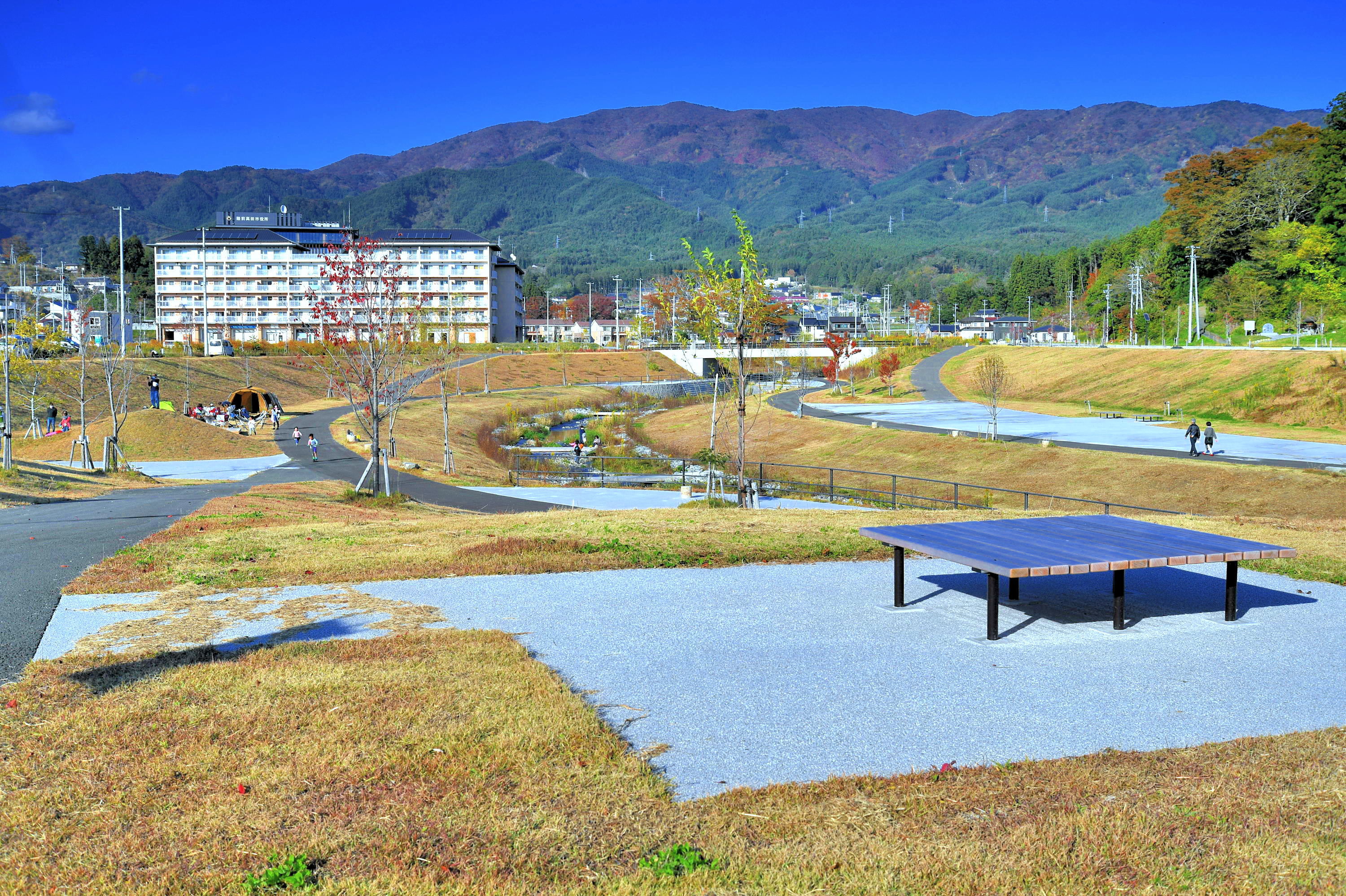
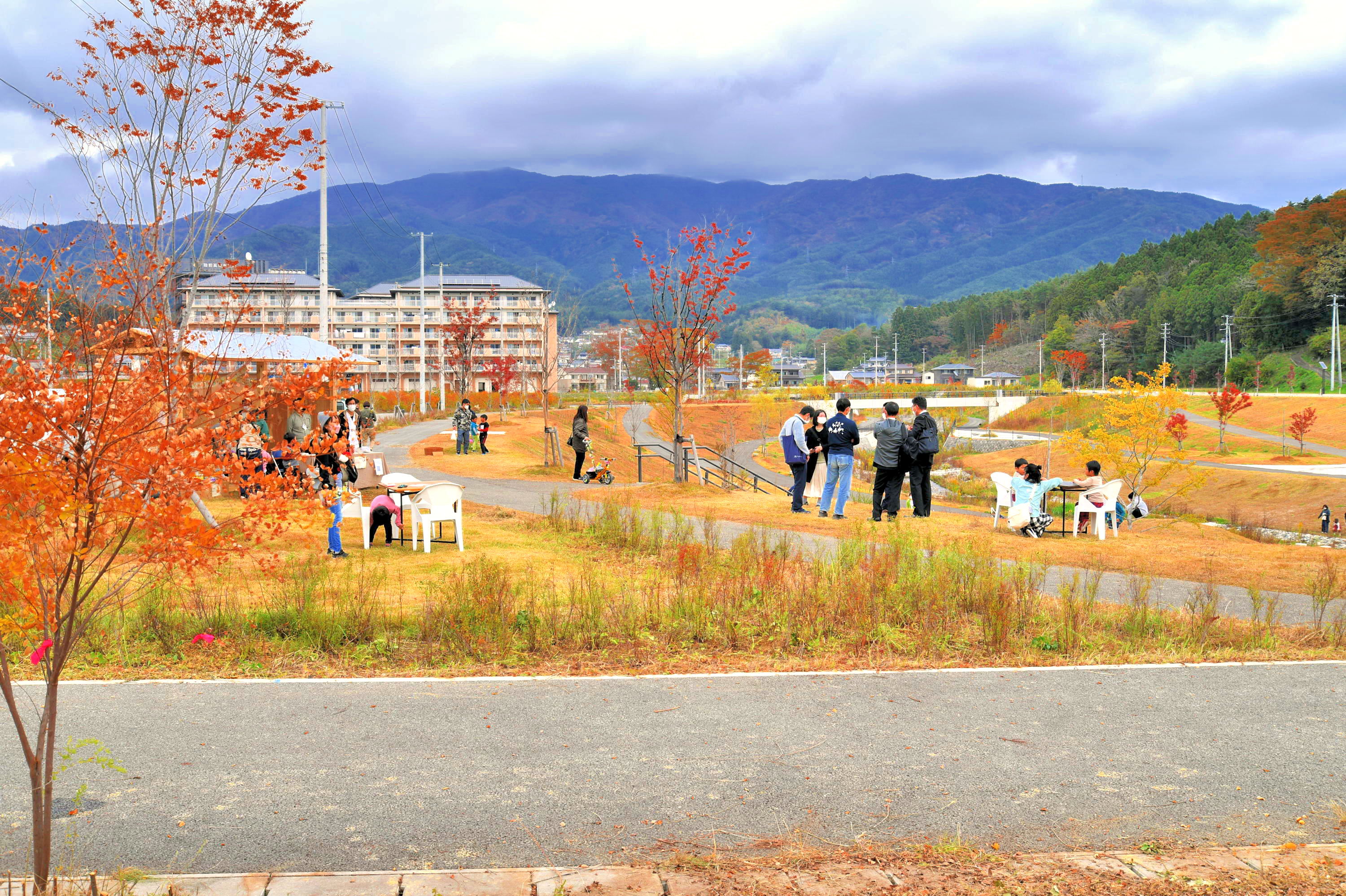
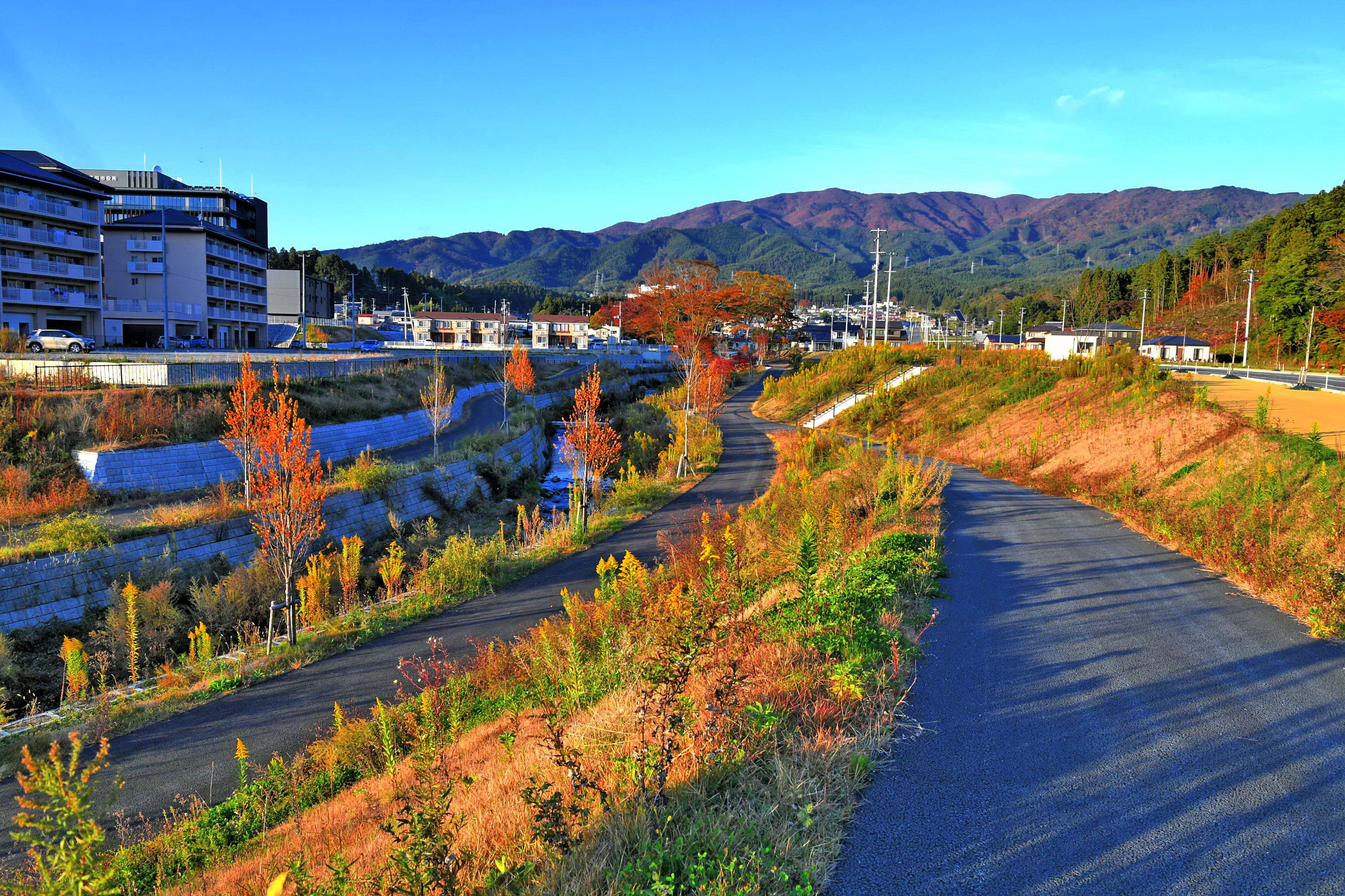
Rikuzentakata City was devastated by the Great East Japan Earthquake, and while the entire city was raised to make it safe from the tsunami, the height difference between the city and the Kawahara River, which originally flows through the center of the city, is large. The challenge for the Kawahara River was to overcome this difference in elevation while preserving the memory of the river and creating an attractive waterfront area. As one can see from entering the river at the site, the concern about the height difference was unfounded.
The distance from the riverbed to the water’s edge is natural. From the riverbed to the height of the town, the landscape is like an embankment, and it is a natural part of the river landscape. The simple design of the bridges, which are placed here and there, allows visitors to enjoy the flow of the river and creates an attractive soundscape with the sound of the rapids, which must have been intentionally created. It is a place where children might venture out to the water’s edge. In fact, it seems to produce “kawagaki,” and on the day of the inspection, kawagaki were out early in the morning catching fish with mysids, accompanied by their sleepy father.
Wherever possible, the slope of the river channel has been changed to create a hydrophilic slope, trees have been left standing, and the shoulders of the river have been carefully designed to create a green space, creating an expansive and pleasant landscape. In the upper reaches of the river, which were not damaged by the tsunami, trees remain to preserve the memory of the Kawahara River, creating a landscape that links the past with the future. Perhaps for this reason, many citizens use the area for strolling and enjoy the waterside in a very relaxed manner. Numerous benches have been placed and the shade under the bridge is well used.
The river has been created to give courage to the reconstruction of the city and to give children dreams for the future. (Nakamura)
We walked along the river from downstream to upstream. Perhaps because the undulations, including Mt. Hyogami, were visible in the space, we hardly felt that we were at the bottom of the raised ground. The terrain, the trail, and the river were so well arranged that one might think that in the future, when the trees grow up, this area will feel like a natural terrain. This is probably due to the unique arrangement of the retaining wall revetment, abandoned stones, and the sloping embankment made of earthworks.
At the upstream end of the site, trees from before the disaster were left behind, and without information, it would have been difficult to tell what had been done to the site, which made me groan at the skill of the design supervisors. From there, we walked toward the downstream section, but our impression of what lay ahead remained the same.
It was after 3:00 on a weekday when I visited the site, and several people were already strolling. After a while, several people who appeared to be high school students leaving school arrived in groups, scattered here and there in the park, and finally gathered at a small bridge on the Kawahara River to chat, which the townspeople could see from the bridge connecting the raised ground.
The Hyokamiyama mountain could be seen in the background, confirming that the design intent of creating “a space in the city that is both a river and a park” was a success. We highly evaluated the realization of the design intent and the fact that it is familiar to the citizens, and awarded it the Grand Prize.
However, we were disappointed with the silhouette of the bridge, which is an important visual object as a river landscape. Although it seems that it is not subject to entry (evaluation), I would like to note here, as a preliminary request to those who may do similar projects in the future, that it would have become a space that looks different even if the fascia line was at least run through to the abutment and the parent pillar was placed in the proper position. (Matsui)